
Organiser
NXSN
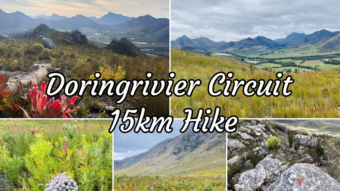
Doringrivier Circuit is a 15km hike. The peak with approximately 769m elevation which we will embark, is the highest point on the Doringrivier Fynbos Trail and takes around 6 hours to complete. (Rating 7/10).
The vegetation, unlike the rest of the mountain fynbos in the area, was protected during the 2018 wildfires that burnt 108,000ha, and is pristine. This is a trail for Fynbos enthusiasts especially now that it's in season and offers comprehensive panoramic views of the Outeniqua Mountains from the north. Water is available from the rivers in the valley.
We'll pause a while for refreshments at the peak, before we tackle the descent in a circular route back to the starting point.
👉🏻 Compulsary items: Suitable lightweight hydration-/backpack, sunscreen, hat, comfortable shoes, something to eat, enough water. Lightweight windproof jacket/fleece, beanie and gloves depending the weather. (We will aim to postpone the hike in the case of rain, but a waterproof jacket might be a handy kit item). Best to always dress in layers. Space blanket, emergency energy bar/trail food, bandage, small petroleum jelly comes in handy for chafing etc.
✨ Optional items:
Fingerless gloves, hiking poles, buffs, coffee.
♡ Meet at the Doringrivier starting point (Pin drop to follow) from around 5h45.
4
Maps link: https://maps.app.goo.gl/p8MS1BSikg4rieEW6?g_st=iw
♡ Hike starts strictly at 6h00.
To stay up to date with all arrangements and hikes by NXSN, you can join the w/a group, here:-
https://chat.whatsapp.com/K5bE7CKzhrrIFv97rUQneH
For any other information, contact Mariàn on 0636977726.
More information: www.facebook.com/share/1YNFPZNTxg/?mibextid=9VsGKo
Event has been Closed
Images of the event
NXSN
Classes and pricing
Available classes for the event
| Class | Distance | Start Time | Price (pp) |
|---|---|---|---|
| Doringrivier Circuit 15km Hike | 15 km Approx 724m elevation | 06:00 | R 150.00 |
Event has been Closed
Event location
Doringrivier Hike Start, Bomate
| Coordinates | -33.86865452018, 22.32672026935 |
| Address | Western Cape |
| City | Bomate |
| Province | Matabeleland North Province |
Event has been Closed